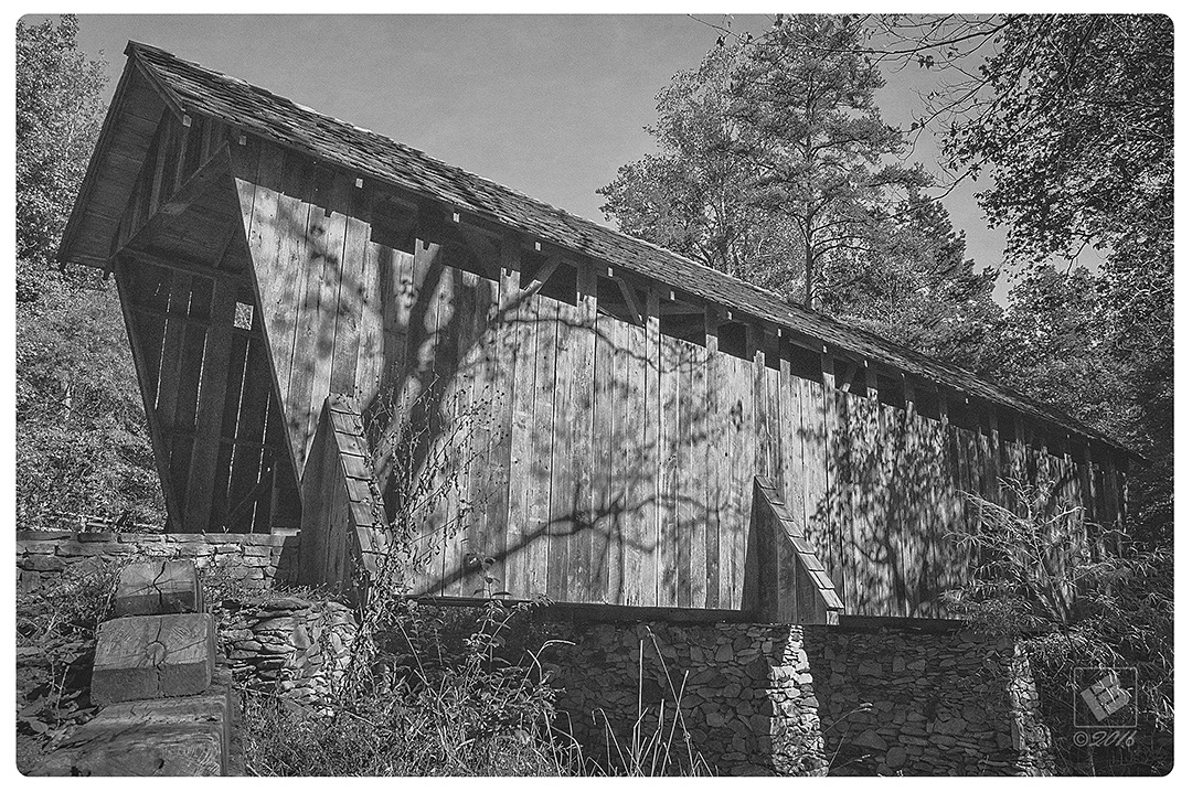
The Pisgah Covered Bridge
This is the last remaining covered bridge located on Pisgah Covered Bridge Road in the southwestern part of Randolph County. It was built in 1911, is 54 ft. long and spans the west fork of the Little River.
The bridge was nearly washed away in a flash flood back in 2003. With the historic landmark being such an integral part of the tourism industry here, several state and local agencies including the NC Zoo partnered to restore the bridge soon after. In addition, a short nature trail was built that loops around through the woods behind the bridge.
Skeen’s Mill Bridge
The Skeen’s Mill Bridge was located on Covered Bridge Road (SR 1406) just below Mount Pleasant Methodist Church near the community of Tabernacle. When I was growing up, I spent a lot of time on our family farm not too far from there. From time to time we would drive by to see it on our way to and from Asheboro.
This bridge was built in 1900, and at 100 ft. long was nearly twice the length of The Pisgah Covered Bridge. As I understood it, the state had approached the landowner many times to no avail about trying to preserve it. Sadly, it fell in the Uwharrie River and washed away when I was in high school in 1987.
I unfortunately don’t have any personal photos of this bridge, but I did find a page on flickr with an old postcard depicting the bridge. I also found an interesting article about the history of it here. The researcher goes into quite a bit of detail about the old mill site located down river from the bridge. ~MB
Additional Information on The Pisgah Covered Bridge
www.heartofnorthcarolina.com
Photos showing aftermath of flood and restoration – link